Author: Bill Senior
Every day, water managers throughout the Murray-Darling Basin are faced with the difficult task of balancing precious water resources between the competing interests of agriculture, towns, and the environment. The ‘environment’ is a hard thing to pin down. It contains a myriad of components, of which extensive floodplain habitats and the iconic tree species they support, are a significant and valued part.
Generally speaking, we try to preserve the things we value, and to do this we need to know how much water trees need to sustain themselves. Trees need water – it’s a truism, but exactly where do they get it from? They use their roots to get it from the soil, I hear you say, but where exactly does the water in soil come from? The further you dig (literally!), the more complex and difficult the questions can become.
In the past, there has been a strong focus on defining watering requirements of floodplain trees purely using inundation from flood events (for example, species X must be inundated at least once every Y years for at least Z days/weeks). Flooding almost certainly plays a significant role in supporting certain aspects of a tree’s life cycle, however, it is not the only source of water available to trees to keep them alive. There is rain, and there are also pockets of water under the ground. These sources are potentially connected, but still more questions arise about why, how and where those connections occur.
Previous work undertaken by colleagues who specialise in environmental risk assessments, particularly for Water Resource Planning, have suggested that some of the floodplain trees in the Queensland portion of the northern Murray-Darling Basin have experienced periods without flooding much longer than their published tolerance thresholds, and yet they still survive. Here was good evidence to suggest trees may be using other water sources. Shallow groundwater, in particular, was thought to be supporting the good condition of some trees in this region, but again, to what extent?
Answering those questions:
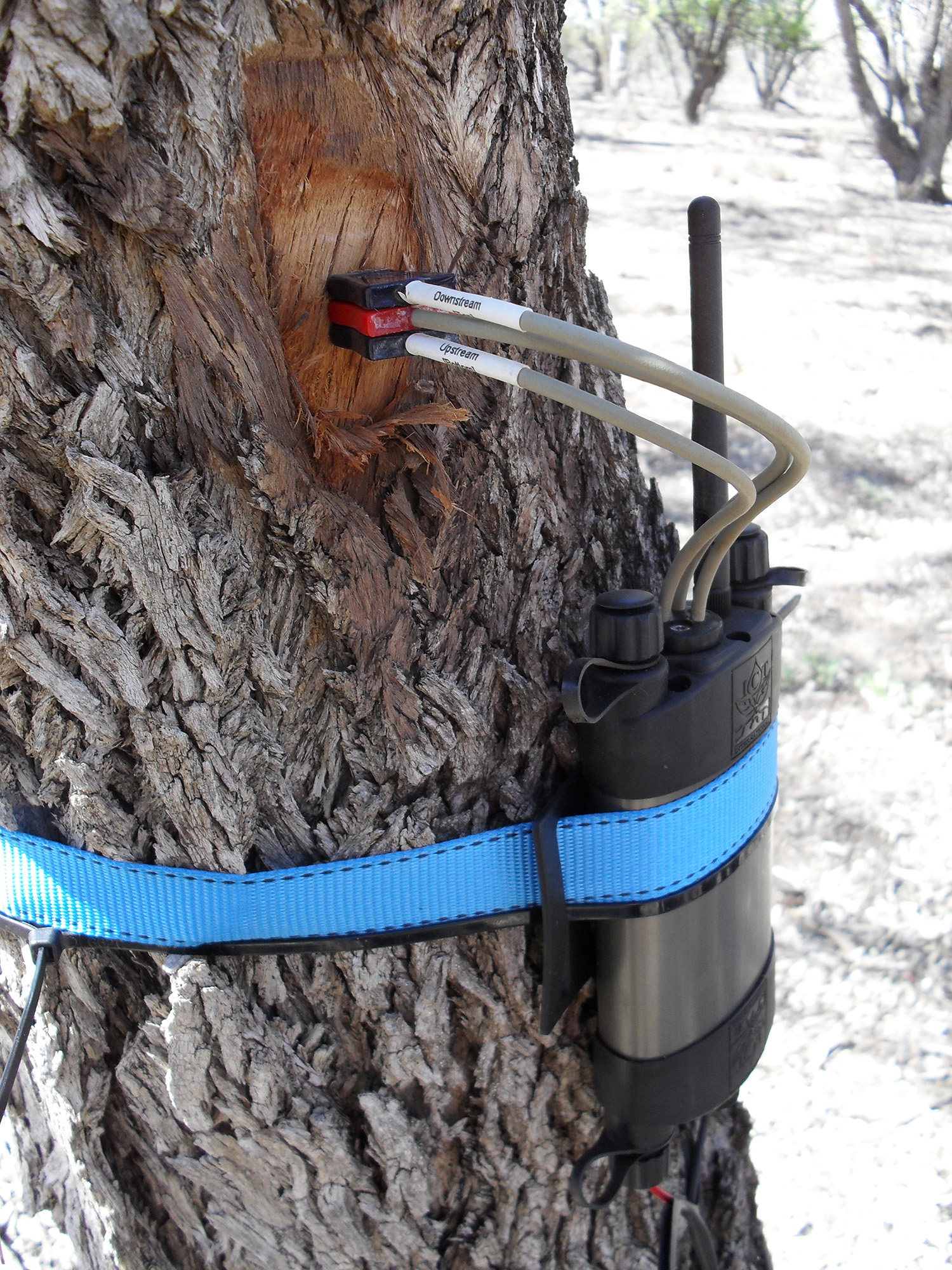
All these questions (and more!) have formed the basis for this MDB EWKR study. For the last two and half years, a team of multi-disciplinary scientists from the Queensland Government have been investigating four key vegetation species, Coolabah, River red gum, Black box and Lignum, in an attempt to understand the different water sources they use, and the amount of water they require to maintain their condition. We have been studying floodplain tree water use in the Lower Balonne Floodplain: an area spanning the Queensland/New South Wales border within the northern part of the Murray-Darling Basin. Our primary focus has been on Coolabah (Eucalyptus coolabah), as this tree species is the least researched, yet the most common large eucalypt species across the study area.
We have been investigating vegetation water use at two distinct spatial scales;
- tree/site-based
- vegetation patch/landscape-based
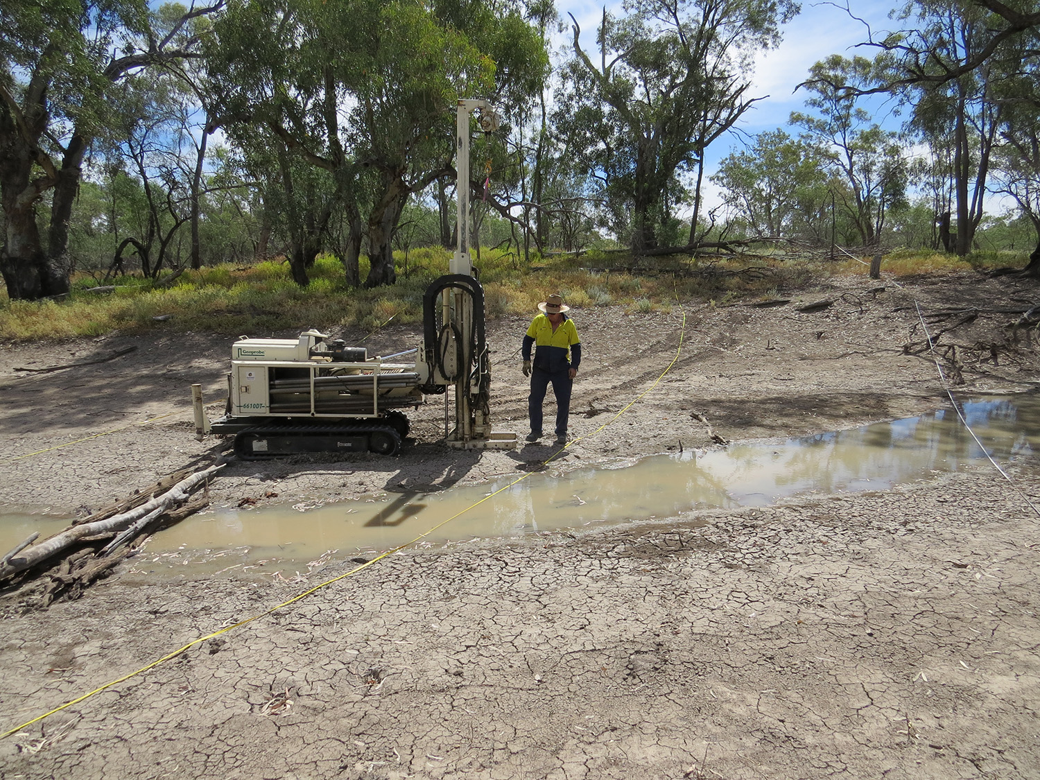
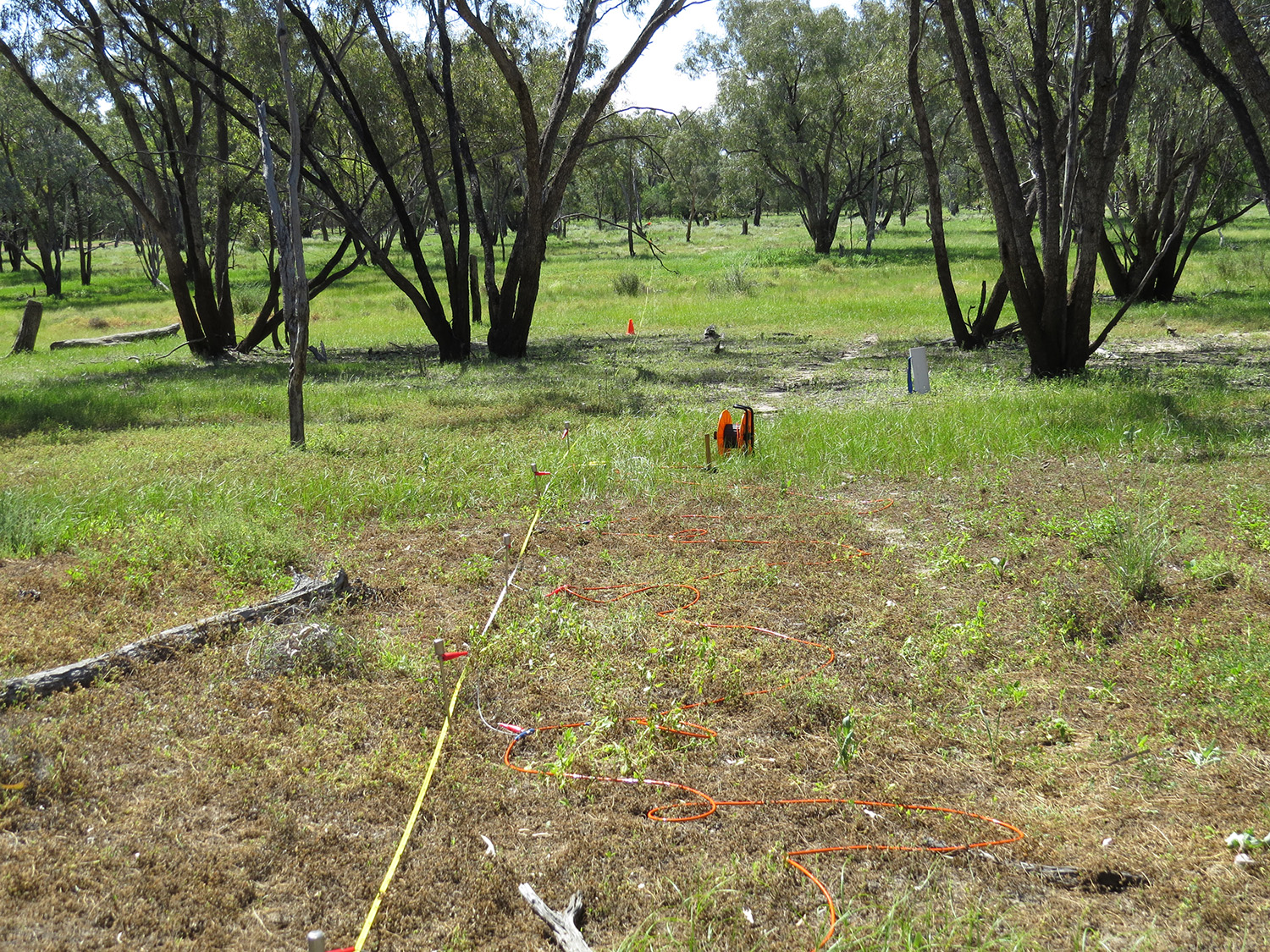
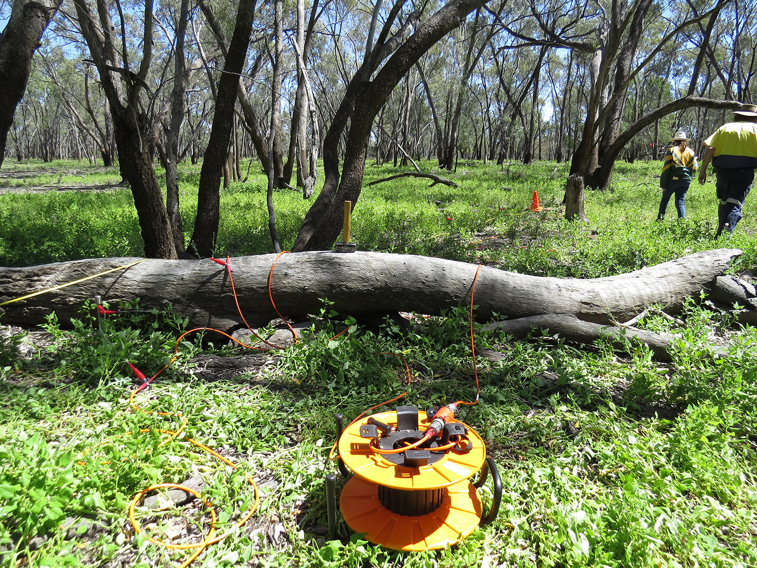
At the small scale, we have collected a large amount of biological and physical data on specific water use by trees, and also undertaken a detailed characterisation of the underlying soils and hydrogeology.
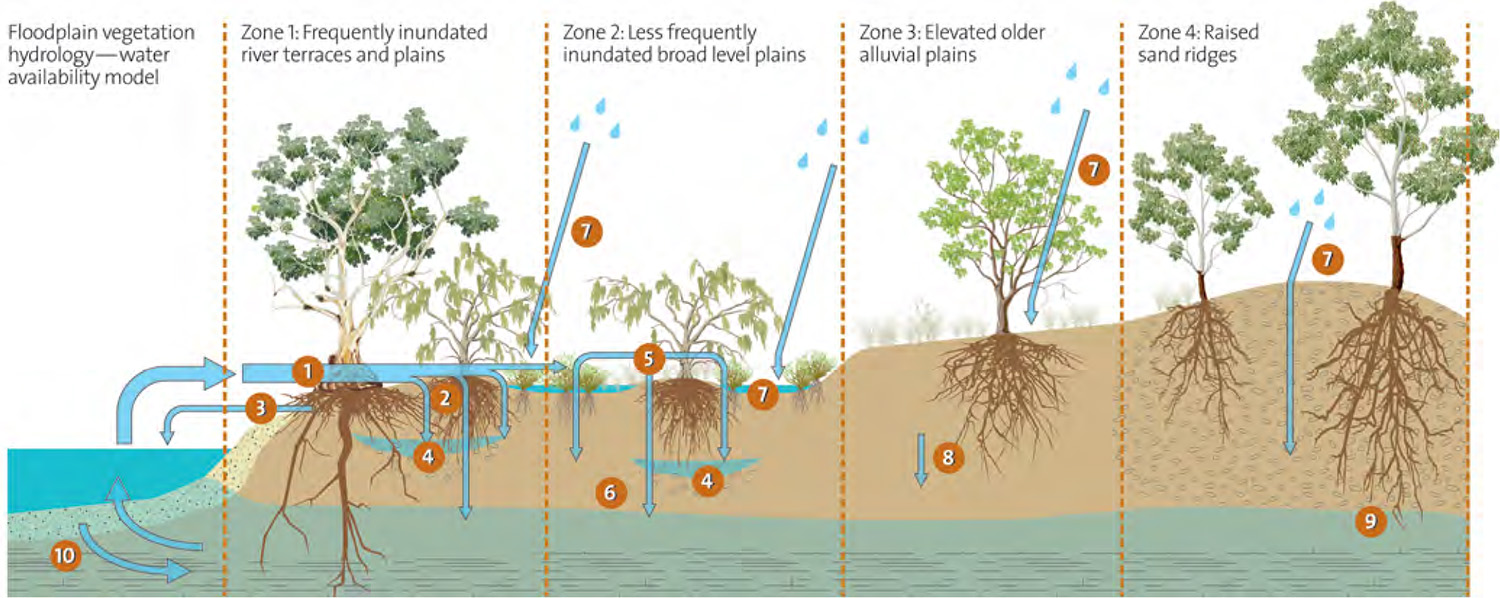
At the larger scale, we have used a remote-sensing approach to assess vegetation condition across the region using a time-series of LANDSAT satellite imagery from 1988 to 2016. This information has been used to develop a conceptual model to help communicate our understanding, and piece together the story of what water is available to vegetation and how it’s all connected. The diagram below illustrates the questions we are asking about water and vegetation.
What have we found?
We are still in the process of bringing all the results together for this study, but some interesting findings are emerging that potentially challenge some of our conventional thinking.
The concept that a single inundation threshold can define the water requirement for a floodplain tree species looks too simplistic. We have good evidence from direct observation at the site scale, as well as from remote sensing analysis, that trees are using groundwater in certain locations. When we analyse the greenest trees during dry periods (those that are maintaining good condition despite a lack of rain or floods), it appears that there are many locations where trees look likely to be accessing groundwater. This can be seen by looking at the distribution of the greenest areas compared to mapped vegetation patches which are dominated by the individual species we are studying.
In other parts of the floodplain, where accessible groundwater may not exist, our results suggest the variation in condition of Coolabah trees is actually better explained by climate (rainfall and evaporation metrics) than it is by the occurrence of floods, at least over the last 30 years (the period for which we have satellite imagery).
The evidence is beginning to stack up. Some of these trees may not be as flood dependent as we thought.
Implications for managers:
One thing we are sure of is that the story is complicated. As was said at the beginning of this article; trees need water – but ultimately they are not fussy where they get it from. The water sources trees use are dependent on many things such as their position in the landscape, whether it floods (or not), the soil they are sitting in, whether they are above accessible groundwater, whether that groundwater itself may be recharged by floods, and how often it rains on them (or not).
This means that in many (if not most) cases, the sources of water that floodplain trees use will be specific to a particular location. Whilst this makes it difficult to generalise, is it is hoped that findings from this project will have practical implications for water managers by highlighting the potential contribution of other water sources (particularly shallow groundwater) in maintaining the condition of trees on parts of the floodplain.
Our study started with many questions, and it is almost certain that other, albeit potentially different questions, will remain at the end. It will contribute to the overall body of knowledge on vegetation water use, particularly in the northern Murray–Darling, where region-specific knowledge on floodplain vegetation has traditionally been thin on the ground. Ultimately it will hopefully lead to increased confidence in managing water resources for the benefit of all users in the region.
For more information:
- contact Vegetation Theme Co-ordinator, Cherie Campbell: cherie.campbell@latrobe.edu.au
- contact Centre for Freshwater Ecosystems: cfe@latrobe.edu.au
Related Links:
- More Valiant Vegetation stories
- visit the website, Facebook or YouTube