Author: Heather McGinness
Gaia, Elvis, and Elf are more than just waterbirds — they’re birds sporting lightweight GPS mini-backpacks for the sake of science. But why?
With waterbird populations in decline across the Murray-Darling Basin, and limited quantities of environmental water available to help address this decline, our efforts to improve and maintain waterbird habitats need to be guided by better knowledge of what waterbirds need, where, and when. This comes down to understanding more about how they use their habitat (e.g. where they fly, stop, feed, breed and roost), and the scales at which these habitats and environmental flows are required to support waterbird recruitment.
Filling the knowledge gaps on waterbird ecology in the Basin will assist environmental water managers to provide water in the right places at the right times to better sustain the varied habitats that waterbirds need through their life cycle. This will not only support successful breeding events — the focus in the past — but also promote juvenile survival, and ultimately, healthy waterbird populations.
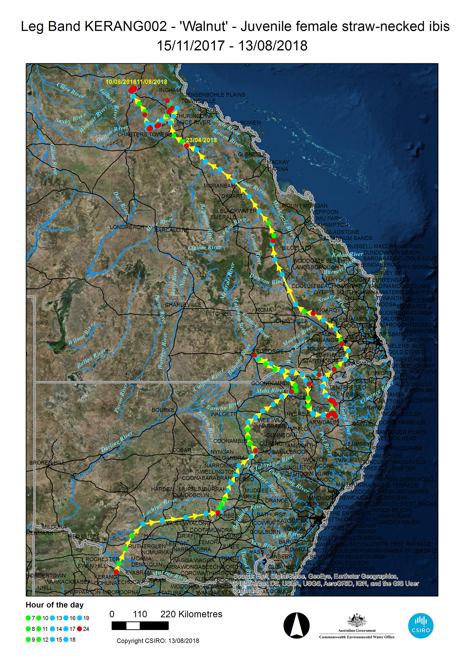
The MDB EWKR Waterbird Theme are starting to fill some of these knowledge gaps by tracking the movements of Gaia and friends using satellite GPS transmitters. The transmitters record hourly location fixes during the day, and a midnight fix to record roosting/nesting locations. The satellite-tracked ibis and spoonbills are providing invaluable information on where waterbirds go and how they use their habitat.
Learn more in our short video below:
Project Update:
The Waterbird Theme team have been have been VERY busy over the past few months, crunching data and keeping up with our satellite-tracked waterbirds.
Most recently, a call has gone out via social media challenging locals and citizen scientists to spot satellite-tracked birds and send in photos and other information.
Our satellite-tracked ibis and spoonbills are all around eastern Australia, and although we have satellite imagery to give us an idea of the areas our birds are using, we would like to know on-the-ground details too.
Once a week, we will be releasing details of the most recent locations of individual birds via Facebook (Waterbirds Australia) and Twitter (@AusWaterbirds). We’ll provide a satellite map of recent movements and GPS coordinates for the most recent location, which you can type into your phone, GPS or similar device.
How you can help?
If you are in the area, we challenge you to check out the locations and look for the bird. Any photos of the bird and the area it is using would be helpful too – you can submit them here.
We would also like to know:
- How many other birds is it with and of what species?
- What’s the ‘habitat’ like? For example, is it wet or dry? Grazing paddock or wetland?
- Can you see the satellite transmitter on the bird’s back and/or the bird’s coloured leg bands?
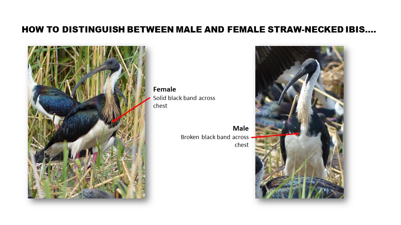
- If the bird is a straw-necked ibis, are they hanging in a group with mostly male or female straw-necked ibis? How many juveniles or adults are in the group? (see guides below)
Note: Please remember to stick to areas which are publicly accessible.
For further information:
- contact Heather McGinness: heather.mcginness@csiro.au
- visit the CSIRO project website, or our Facebook and Twitter page
Related links:
 The EWKR Waterbird theme is led by the Commonwealth Scientific and Industrial Research Organisation (CSIRO).


